
The stage extends between Fafião and Cabril, passing through Pincães, covering a little over 8 km, in a rural and mountain environment.
Take care to look out for the waymarks and signposts for the GR50 as there are several intersections and branches along this stage, as well as other marked routes. The signposts relating to the GR50 are clearly identified and, along this stage, are numbered from 15.1 to 15.48 (a numbered plate attached to signposts, the supporting post of information panels or direction mark). Always follow the GR50 waymarks and signs that indicate the direction of ‘Cabril’
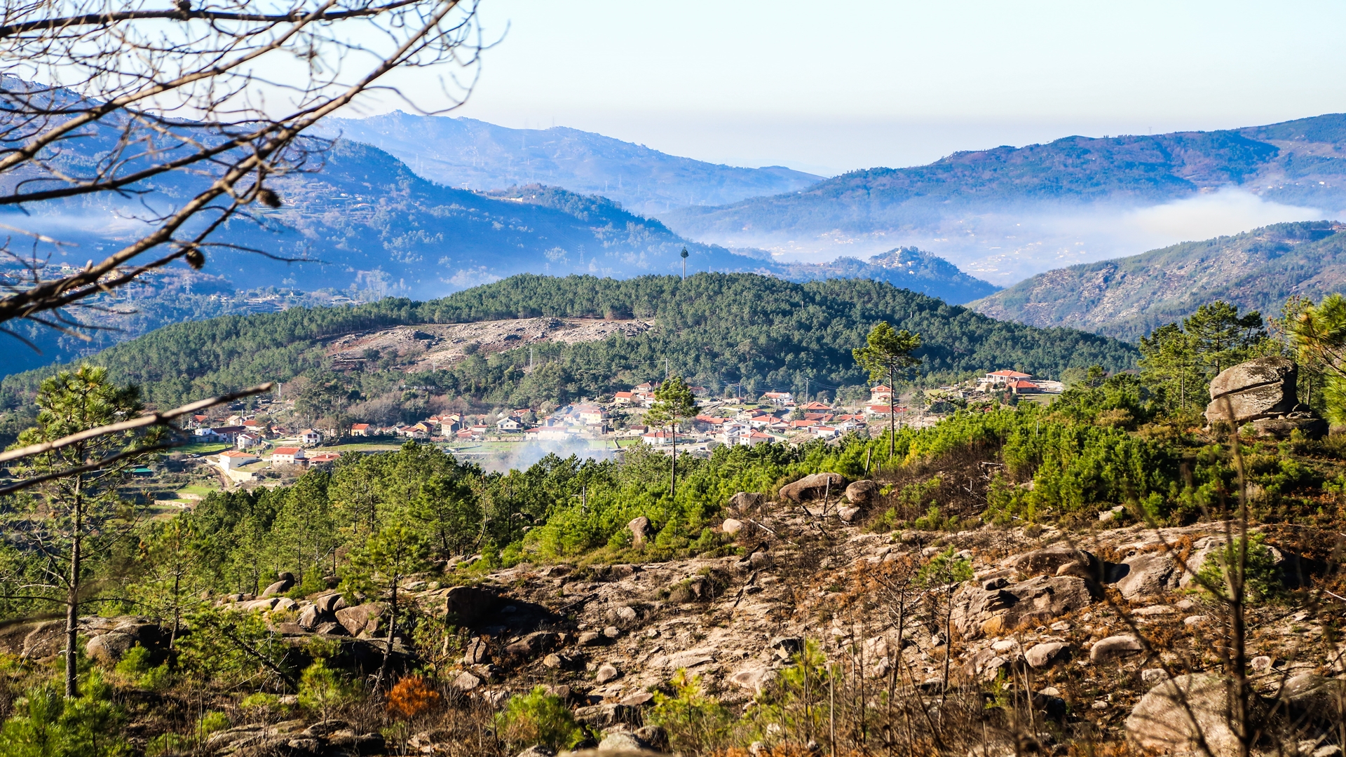
The walk starts in Fafião in Largo da Sobreira do Chão, from where we climb the tarmac paved road, passing alongside the Café Fojo dos Lobos. We continue following on the tarmac, passing a series of new buildings, then taking the fork to the right, next to the football field. We pass through an area of pine wood until we reach a junction with the main road that connects Fafião to Cabril. We turn to our left and walk along about 100 meters of road, until we enter a forest track on the left, which leads us to Roca das Cabreiras, where the route reaches the highest point of this stage at 730 meters. The track crosses a large wooded area, of mainly pine trees and part of the Fafião common lands. On nearing Roca das Cabreiras the route enters a fenced portion where gates have to be opened in order to continue along the way. Don't forget to close them after passing through! We reach a picnic area, an ideal spot for a break!
After passing the second gate the way becomes a narrower and irregular path. Another 500 meters and we reach Roca das Cabreiras where we skirt around the granite mass. From this high point we already have a good view of the river valley and the village of Pinçães which we will reach in a further 2.5 kilometers.
We continue on the way, sometimes walking on stone slabs, sometimes on gravel, always accompanied by a magnificent and unobstructed landscape. On this part of the route we pass areas of scrub, containing heathers, gorse and thyme, some of the characteristic natural habitats of the Gerês mountains and which contribute to the special quality to the honey of the region.
The next high point on the route is the traverse of the headwater of the Pincães river and from where we can gain a perspective of the full height of the Pincães waterfall. Don't go near the edge, it could be dangerous! Lower down the route offers the chance of visiting the waterfall by a safer path and from where you will have a better view.
About 200 meters after passing the headwaters of the Pincães river, we enter a path on the right that leads us down to the old Pala Doce track, which in turn takes us to the village of Pincães. Here we will find signs that indicate an option for visiting Pincães Waterfall, as well as the way ahead to continue to the village. If you choose to visit the waterfall do take appropriate precautions to avoid slipping and falling! In Pincães be sure to see the group of traditional houses, the espigueiros (maize stores), the mills, cattle byres and the Pedra d’Agua, which all tell us much about the culture of this community and the surrounding region.
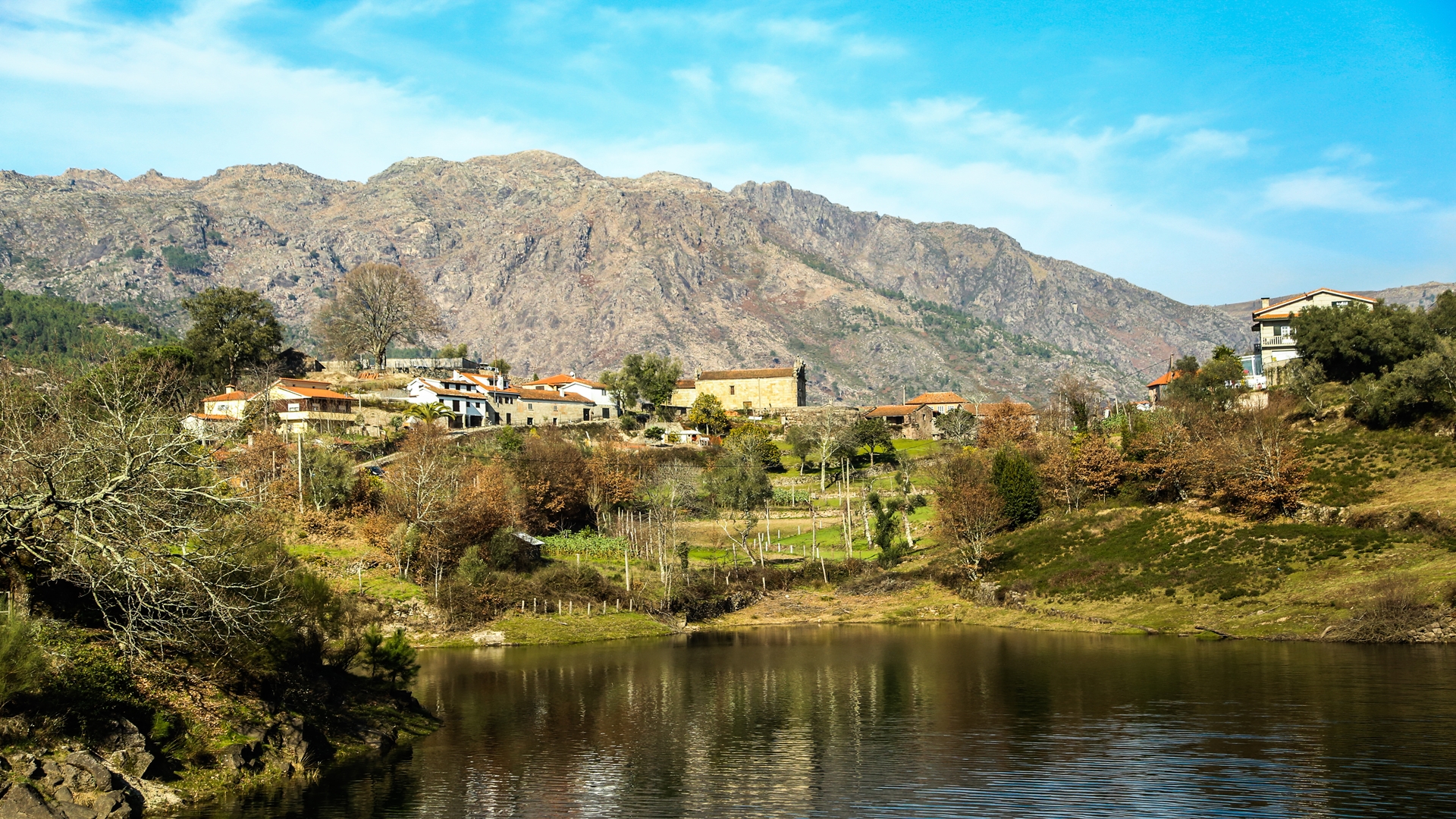
We leave Pincães on the municipal road, passing in front of the Chapel of Pincães, and soon after we enter a country lane, on the left, which leads into a broadleaf woodland. We follow this track parallel to the road, which we rejoin further ahead and then turn off to the right onto a narrower lane, still on asphalt, which passes through an area of pine wood. A few meters later we change direction again, now following the track parallel to the Salamonde reservoir until reaching the bridge over the Cabril river. We cross the bridge and follow to the left along the road to the center of the village of Cabril where the stage ends.
In Cabril we can find some support services, specifically hoteliers (accommodation and catering). Be sure to visit the village which extends along the valley of the Cabril river and with a unique surrounding landscape, notable for its patchwork of water-meadows and fields, the expanse of water of the Salamonde reservoir and the granite massifs of the Gerês mountains.


