
This stage connects Lindoso to the village of Ermida along a route of about 12 kilometers that crosses a large part of the Serra Amarela. Although it does not get above an altitude of 1000 meters the route is located in a mainly mountain environment without support facilities between the two villages. Top up with provisions before you set out. The Serra Amarela hills are also known for fog that can sometimes form very quickly. If the weather is not settled it is best to wait for another day!
Take care to look out for the waymarks and signposts for the GR50 as there are several intersections and branches along this stage. The signposts relating to the GR50 are clearly identified and, along this stage, are numbered from 8.1 to 8.44 (a numbered plate attached to signposts, the supporting post of information panels or direction mark).
The walk begins next to the cross in Lindoso. We follow the principal road passing in front of the PNPG Gate Information Centre and the Parish Church and continue about 150 meters through the inner part of the village until we find a sign indicating a left turn up towards the mountains and the village of Ermida. A little further ahead you come to a gate which closes off the cattle that are free to graze in the upland pastures. Leave the gate exactly as you found it.
Over the next four kilometres the way forward is always uphill, eventually reaching the area of Carqueijal, which is the highest point of the stage (about 910 m), not far from the summit of Louriça which is the highest point of the Serra Amarela (1359 m).
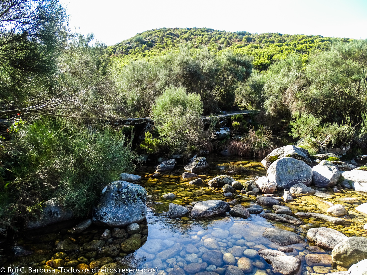
After crossing the forestry dirt road continue along the waymarked footpath which leads to the former Forestry Guard House at Porto Chão, a place name that is associated with the existence of an ancient mountain village, possibly of medieval age. From here we follow a wider dirt track until reaching Mulas stream and the abrigos (shelters) at Bugalhedo. Two hundred meters further on appears a sign indicating the direction towards Ermida. So we follow the indicated way to the right and begin the descent into the village of Ermida.
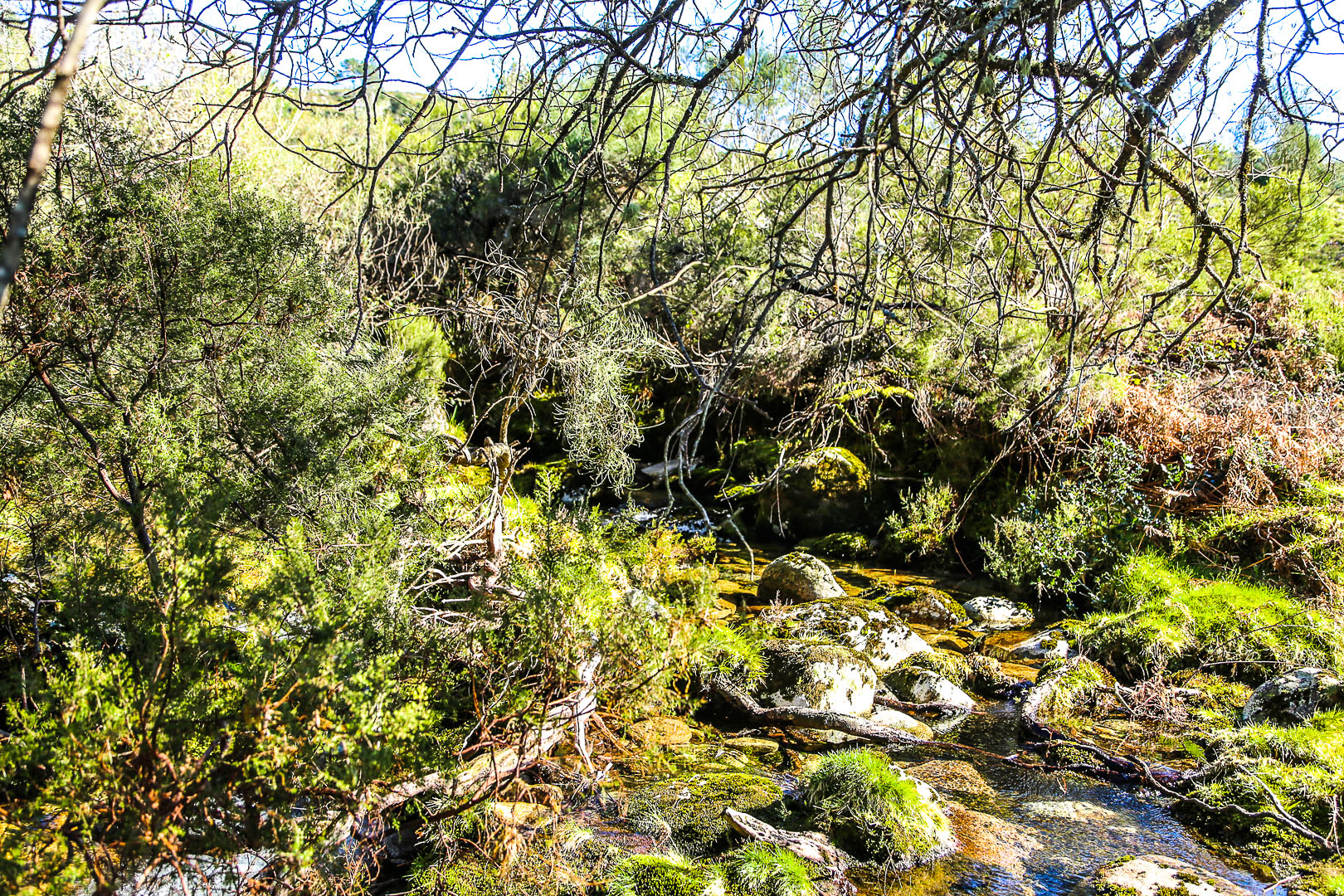
A little further ahead we cross a small bridge. We are at the headwaters of the Porto stream, which has a confluence here with the Perdiz brook. Soon after we reach the pleasant corral and shelter of Escaravelheira or Escravilheira.
We continue on our way, always with the Porto stream on our right. We pass through areas of mainly of low scrub and small copses, encountering flatter areas that form in areas of runoff from the hillsides. In these flatter, wetter and more sheltered areas small copses and peaty habitats occur which provide valuable sites for the fauna and flora of the National Park. For your own convenience and for environmental protection, try to avoid walking over the wettest areas.
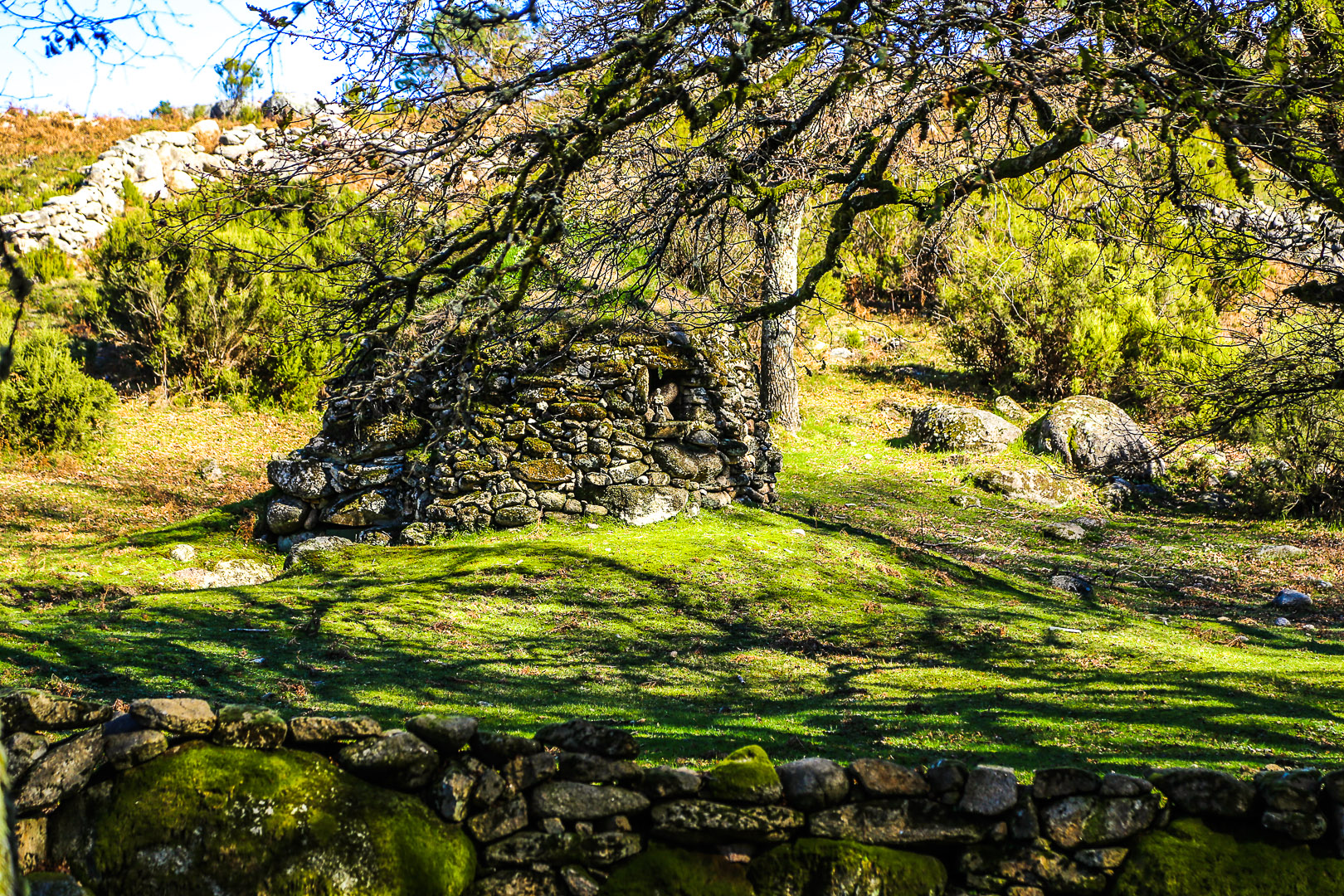
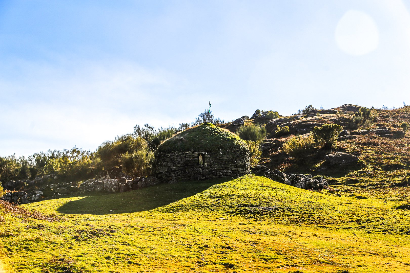
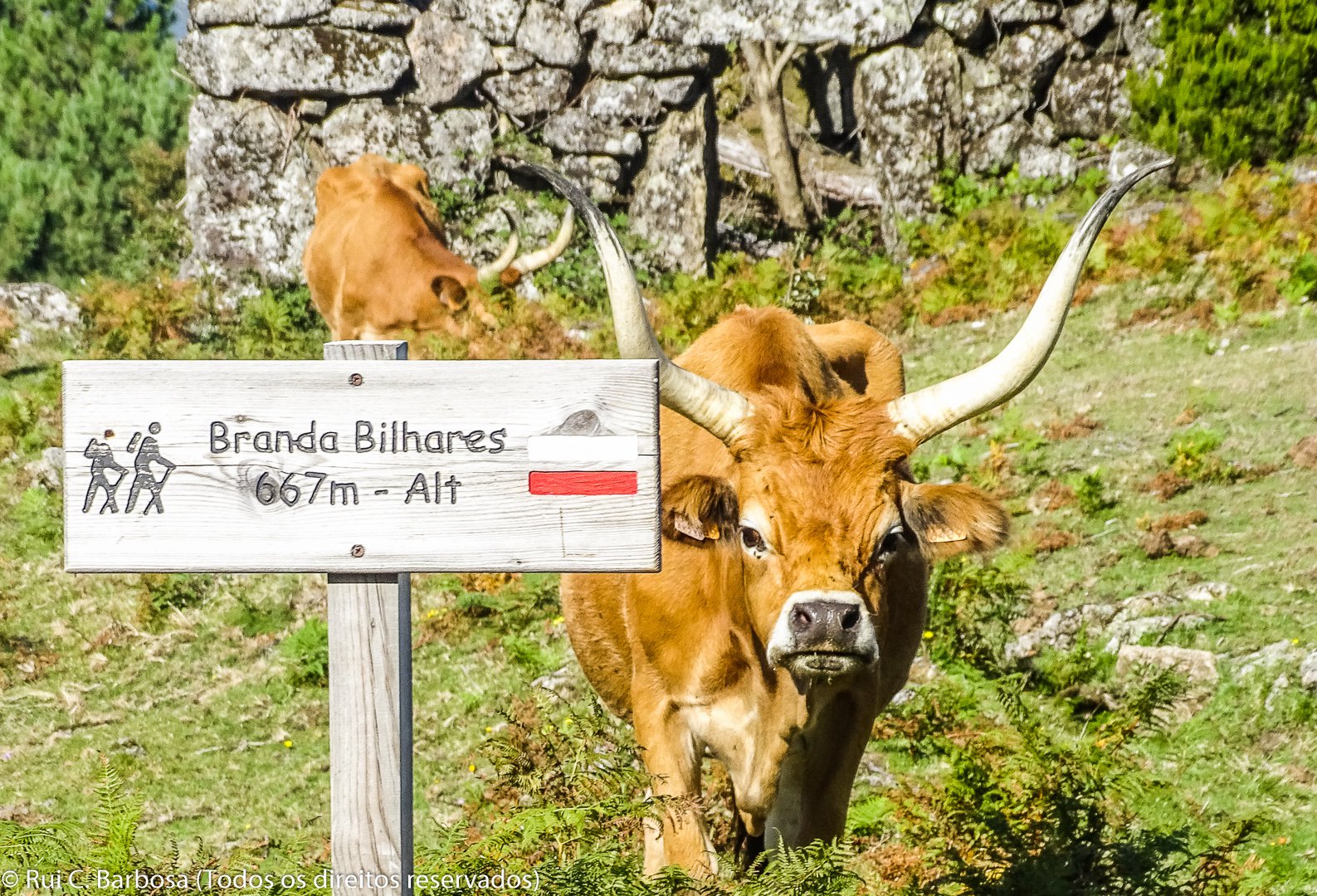
The next mandatory stop is in Branda de Bilhares, an old temporary mountain village, which still contains traces of the Roman occupation of the area. In the land around the branda (summer village) lameiros (water-meadows) and levadas that channel water to the fields stand out. At the right time of year (from May to August) three species of wild orchid occurring in the National Park can be found flowering in these meadows.
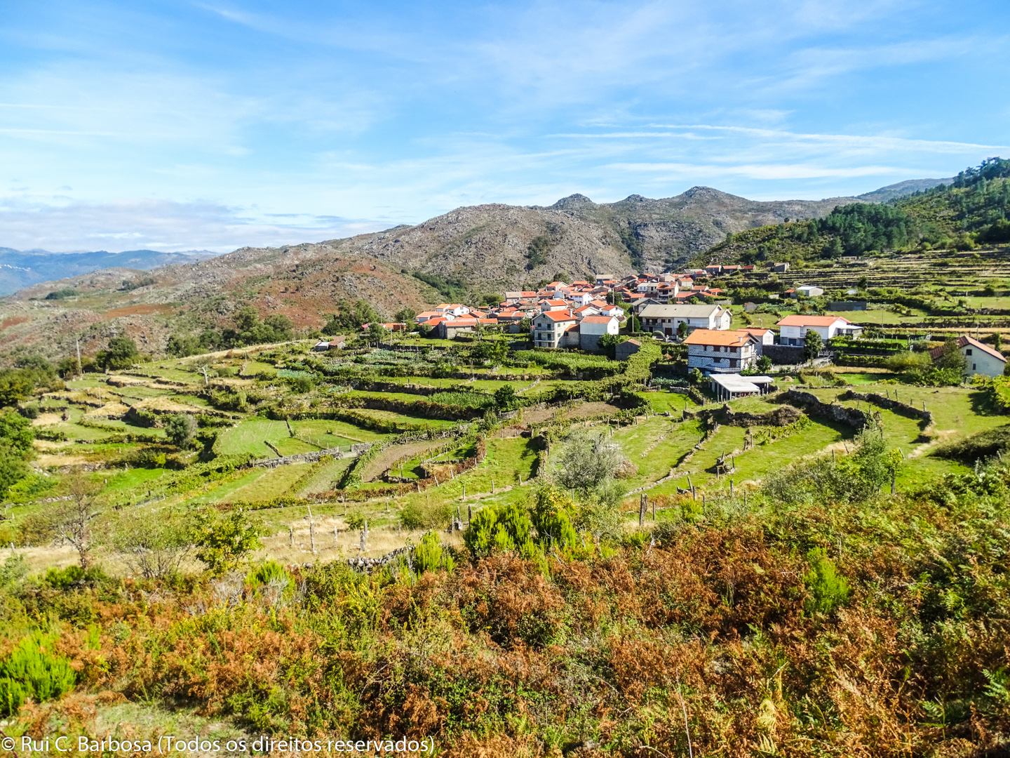
About two hundred metres after leaving Bilhares we take a right turn in order to see more closely the deep valley of the Froufe river. Finally the first signs of the village appear and we are soon entering Ermida, one of the most isolated villages in the National Park, being at the end of the municipal road that serves this side of the Serra Amarela.
In Ermida be sure to visit the small museum which houses important remains that provide evidence of the earliest occupation of the Serra Amarela; the Menir Statue (datable to the 2nd Millennium BC, the oldest anthropomorphic sculpture known in the territory of the National Park) and the Valentine's Stone (of Roman origin).
We leave the village by taking the municipal road that leads to the end of the stage at the Ermida viewpoint, a fantastic balcony overlooking the Froufe valley and the extensive area of terraced fields.
In Ermida there is only one café and some accommodation. The nearest place with more services is Lourido, 5kms by road, where there is also a café, restaurant and grocery store.


